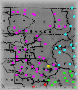
The Yellow "pin" signifies where this site is within the forest.
Click on Purple dots above to visit other sites in this forest.
Click on other colors for sites in adjacent forests. |
Location Data |
|
County
|
Snohomish, WA |
|
Elevation
|
5160 feet |
|
Longitude.Latitude (d.ddd)
|
121.177962, 48.129731 |
|
Longitude:Latitude (d:m:s)
|
121:10:40, 48:07:47 |
|
Township, Range, Section, Meridian
|
T31N R13E S36 Willamette Meridian |
|
Special Management Area
|
Glacier Peak Wilderness |
|
USGS 7.5 min. map
|
Lime Mountain, WA |
|
Map Attributes (extracted 1999)
|
Bm |
Rd=Road, Rd-cc=Road+crossCountry, Tr=Trail, Tr-cc=Trail+crossCountry
Bm=Benchmark, Lo=Lookout, RT=RadioTower
|
Visit a USGS topo map for this site.
You must be web connected for this to work.
|
Photographs |
|
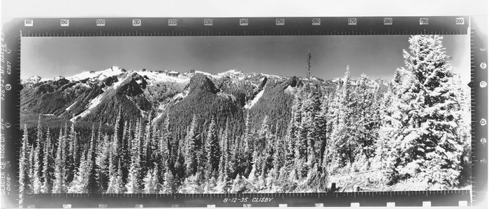
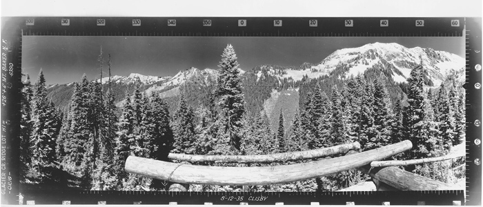
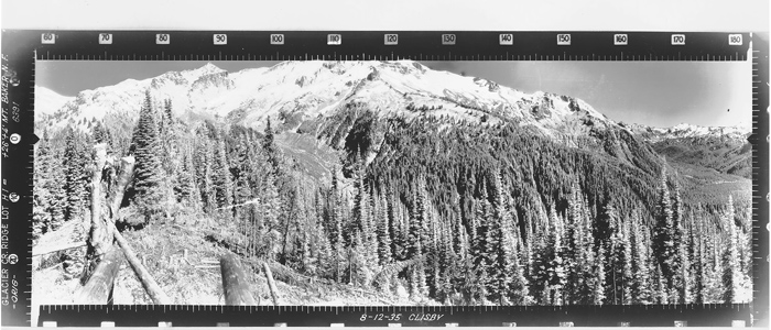
Photographer
|
CLISBY |
|
Taken on
|
Monday, 8/12/1935 |
|
Elevation
|
_ feet |
|
Tower and Camera height
|
26 and 4 feet |
|
Things to see
|
N,E,T |
N=Nature, E=Human Effect, M=Mammal, T=Technology, LO=Lookout, OH=Outhouse
GA=Garage, LC=LookoutConstruction, CC=ClearCut, FF=Burn, SH=Shadow, FL=Flag
|
Other
|
Latest Site details via IamWho Panoramic Imaging Web Site
You must be web connected for this to work.
|
|
|